
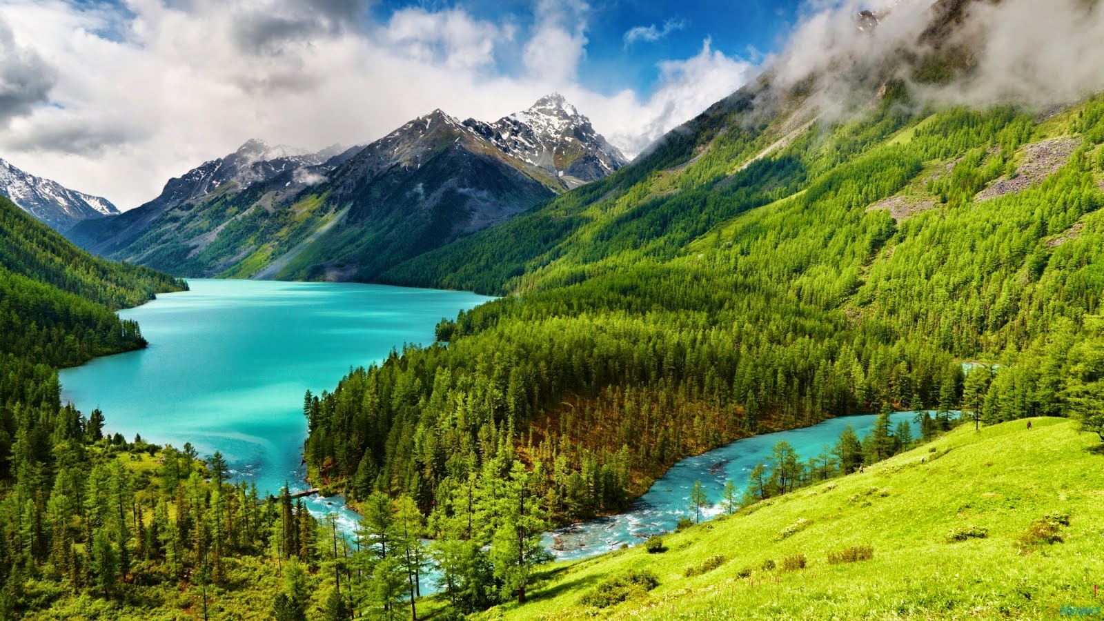
Geography Insights
Dive into geography insights to explore how physical and human environments influence the modern world.
Geography and Society: How Humans Shape and Are Shaped by the Land
Introduction
Geography is more than just about landforms and climate because it’s about how people live, where they settle, how they grow food, build cities, create cultures, and manage crises. From ancient river civilizations to modern megacities and climate-threatened coasts, geography deeply influences society, while human activities continuously reshape the land. This relationship is dynamic, complex, and essential to understanding both development and inequality.
1. Settlement Patterns: Where and Why People Live
Human settlements have always been dictated by geography. Early civilizations flourished in fertile river valleys like the Nile, Tigris-Euphrates, Indus, and Yellow Rivers, where water supported agriculture, trade, and transport. These regions became cultural and political centers.
Today, over half the world’s population lives within 60 km of the ocean, where access to trade and resources drives urban growth. Major cities like New York, Shanghai, Mumbai, and Lagos grew around natural harbors or river mouths. However, this also makes them vulnerable to sea-level rise and hurricanes.
In contrast, deserts, high mountains, and tundra see sparse populations. But even here, geography influences nomadic lifestyles (e.g., the Bedouins in the Arabian Desert) or clustered highland farming (e.g., Andean and Ethiopian highlands).
2. Agriculture and Resource Use
Geography determines what can grow where, which in turn affects diets, economies, and even geopolitics. In tropical climates, year-round farming supports rice and banana cultivation. In temperate zones, wheat and corn dominate. Irrigation has enabled food production in arid regions like California’s Central Valley or Israel’s Negev Desert.
Topography influences farming techniques. In Asia, terrace farming on hillsides minimizes soil erosion and water loss. In flat plains like the American Midwest or Ukraine, mechanized farming thrives.
Resource geography, or in simpler terms, who has oil, water, or rare earth minerals also shapes economies and global influence. For example, the Middle East’s oil reserves grant it geopolitical power. Meanwhile, countries like Chile and the Democratic Republic of Congo, rich in lithium and cobalt, are central to the green energy future.
3. Culture and Identity: Landscapes of Meaning
Geography and culture are intertwined. Mountains, rivers, and plains aren’t just physical features as they’re often sacred spaces, cultural symbols, or strategic landmarks.
The Ganges River in India is a religious icon for Hindus. The Himalayas define spiritual and cultural identities in Nepal and Tibet. Even national borders carry cultural significance. Think of how the DMZ between North and South Korea is both a geographic divide and a symbol of ideological conflict.
Migration, shaped by geography, also transforms culture. Port cities like Istanbul, Singapore, or San Francisco became cultural melting pots due to geographic positions as trade crossroads. The resulting social diversity enriches society but can also cause cultural friction.
4. Urbanization and Environmental Stress
Modern geography is marked by explosive urban growth, especially in Asia and Africa. Cities like Delhi, Jakarta, Nairobi, and Cairo are expanding rapidly, often faster than infrastructure can support. This results in overcrowded housing, pollution, traffic, and waste management crises.
Geography dictates how urban areas are planned. Coastal and river cities need flood defenses. Cities near fault lines (e.g., Tokyo or Istanbul) must engineer earthquake-resistant buildings. Poorer cities often lack such resources, exacerbating risk.
Urban sprawl also encroaches on forests, wetlands, and farmland. This reduces biodiversity and also increases the impact of disasters as more people now live in harm’s way due to poorly planned urban geography.
5. Natural Disasters and Human Response
Earthquakes, tsunamis, droughts, and hurricanes all stem from geographic processes. But how societies respond is shaped by political will, infrastructure, and social organization.
Consider the 2010 Haiti earthquake and the 2011 Japan earthquake and tsunami. Both were severe but Japan’s advanced infrastructure and disaster planning led to fewer deaths and faster recovery. Geography may trigger disaster, but society’s preparedness and inequality determine the aftermath.
In flood-prone countries like Bangladesh, people have adapted with raised homes, floating farms, and flood-resistant rice varieties. However, recurring disasters also cause climate migration, forcing people into crowded slums or across borders.
6. Climate Change and Future Societal Shifts
Climate change is reshaping the human-geography relationship. Rising seas threaten coastal cities, melting glaciers affect water supply, and changing rainfall patterns impact agriculture.
Entire regions like the Sahel in Africa or Pacific island nations face threats of becoming uninhabitable. This could displace tens of millions, creating climate refugees, a new category of displaced persons with no clear legal status.
Cities are now investing in geographic resilience which are comprised of green infrastructure, seawalls, smart zoning but the scale of change required is massive. Understanding geography helps communities adapt, whether by relocating populations, rethinking land use, or developing new technologies.
Conclusion: Geography is Human
Geography is the stage, the script, and sometimes the antagonist of human history. Societies depend on, adapt to, and reshape their environments in a continuous cycle of interaction. From farming in mountain valleys to engineering urban resilience, every societal choice involves geography.
For students, this connection makes geography come alive. It explains not just where things happen, but why. It links environmental studies to history, economics, and even literature. Understanding geography as a human-centered science encourages deeper learning, critical thinking, and real-world relevance in school and beyond.
References
- https://population.un.org/wup/
- https://www.fao.org/agriculture/crops/en/
- https://www.iom.int/migration-environment-and-climate-change
- https://www.nature.com/articles/nclimate3263
- https://www.ipcc.ch/report/sixth-assessment-report-working-group-2/
Real-World Geography Challenges: Climate Refugees, Border Disputes, and Environmental Crises
Introduction
Geography lives in the shifting coastlines, contested borders, and crowded cities that define our time. Today’s most pressing global issues are deeply geographic in nature. Climate change is displacing millions; borders are flashpoints for conflict; rivers are battlegrounds for water access; and cities are collapsing under the weight of overpopulation and environmental degradation. This article presents detailed case studies of these challenges, examining the roots of the problems and the solutions attempted by governments, communities, and international organizations.
1. Climate Refugees: Rising Waters and Displaced Lives
One of the most urgent and under-addressed issues of the 21st century is the displacement of people due to climate change. Climate refugees are individuals forced to migrate due to environmental factors like sea-level rise, droughts, and storms. Unlike traditional refugees, they lack clear legal status under international law.
Bangladesh is a hotspot for climate-induced migration. With over 700 rivers and a large portion of its land below sea level, it is highly vulnerable to rising waters. According to the International Displacement Monitoring Centre, over 13 million people in Bangladesh could be displaced by 2050 due to coastal erosion and flooding. Internal displacement is already straining urban centers like Dhaka.
The Bangladeshi government has responded by investing in cyclone shelters, embankment fortification, and resettlement programs. However, adaptation is costly, and international climate finance has not met expectations.
In the Pacific, small island nations such as Kiribati and Tuvalu face existential threats. Kiribati has taken the extraordinary step of purchasing land in Fiji as a potential relocation site for its entire population. While proactive, the move raises geopolitical, cultural, and legal questions. There is no precedent for full-scale climate migration across borders.
The lack of legal recognition for climate refugees is a significant barrier. The 1951 Refugee Convention does not cover environmental displacement. Advocacy groups are pushing for reforms that include climate-related criteria in refugee protections, but progress remains slow.
2. Border Disputes: Geography as a Fault Line
Geographic boundaries, especially those poorly defined or historically contested, often become the frontlines of conflict. Two prominent cases are the India–China and Ethiopia–Sudan border disputes.
The India–China border, known as the Line of Actual Control (LAC), remains undefined in several sectors, including Ladakh. In 2020, a deadly clash in Galwan Valley resulted in the first fatalities between the two nations in over four decades. Geography plays a central role here: high-altitude terrain, glacial regions, and narrow passes make troop movement difficult and dangerous.
China has constructed roads and infrastructure to assert its territorial claims, while India has responded with military build-ups and alliances. The core problem is a lack of a mutually accepted map. Despite over 20 rounds of talks, resolution remains elusive due to strategic mistrust and domestic political narratives on both sides.
In Africa, the Ethiopia–Sudan border, specifically the al-Fashaga region, has seen recurrent violence. Ethiopian farmers settled the fertile land while Sudan claims historical ownership. The issue intensified after Ethiopia’s civil conflict in Tigray shifted regional power dynamics.
Negotiations have occurred under the African Union and IGAD (Intergovernmental Authority on Development), but no lasting solution has been reached. Border demarcation, land use rights, and refugee movements complicate any peaceful agreement.
These disputes reveal how physical geography, historical claims, and political ambitions intertwine, often with violent consequences.
3. Transboundary Water Conflicts: The Nile and Mekong Rivers
As populations grow and climate shifts water availability, rivers that cross national boundaries are becoming sources of friction and potential conflict. Two of the most significant cases are the Nile in Africa and the Mekong in Southeast Asia.
The Grand Ethiopian Renaissance Dam (GERD), Africa’s largest hydropower project, sits on the Blue Nile. Ethiopia views the dam as essential for its development and electricity generation. However, Egypt and Sudan, downstream nations, fear the dam could reduce their water supply, affecting agriculture and drinking water.
The dispute has gone through multiple negotiation rounds, often mediated by the African Union and the United States. Despite some technical agreements, political tensions remain high. Egypt has even hinted at military action in the past. The GERD crisis underscores the need for binding, science-based transboundary water agreements.
In the Mekong Basin, upstream dam-building by China and Laos has affected water flow, sediment distribution, and fish stocks in Cambodia and Vietnam. The Mekong River Commission (MRC), an intergovernmental organization, exists to coordinate basin-wide policies. However, China is not a full member, limiting its effectiveness.
Communities dependent on fisheries and rice farming downstream report sharp declines in yields. Proposed solutions include joint environmental impact assessments and the development of a Mekong legal framework to govern upstream behavior.
These examples highlight how rivers, once unifiers, can become flashpoints unless robust cooperative mechanisms are put in place.
4. Urban Geography: Jakarta’s Sinking Crisis and Capital Relocation
Jakarta, the capital of Indonesia, is sinking, literally. Nearly 40% of the city lies below sea level, and some districts sink at a rate of 10–20 cm per year. The causes include excessive groundwater extraction, unregulated urbanization, and rising sea levels. The city also suffers from extreme air pollution, traffic congestion, and overcrowding.
In response, Indonesia’s government announced a historic plan: relocate the capital to Nusantara, a newly planned city in East Kalimantan, Borneo. The $35 billion project aims to build a “green and smart” capital by 2045.
However, the plan faces logistical, environmental, and political hurdles. Building infrastructure in forested Borneo raises deforestation and biodiversity concerns. Indigenous groups have raised fears about cultural displacement. Funding is also a concern, with major reliance on foreign investment.
Relocating a capital is not new. One particular example is Brazil, which moved from Rio to Brasília in 1960 but it remains rare. Whether Nusantara succeeds will depend on balanced development, ecological care, and genuine community participation.
Jakarta’s crisis underscores the vulnerability of coastal megacities worldwide, from Bangkok to Lagos to New York. Urban resilience planning, sustainable water use, and population management are becoming essential components of urban geography.
5. Lessons and Reflections
Each of the above case studies reflects a unique facet of real-world geography challenges:
- Climate refugees highlight the failure of current legal systems to address slow-onset disasters.
- Border disputes reveal the fragility of peace where natural features become strategic boundaries.
- Transboundary rivers emphasize the need for environmental diplomacy and shared governance.
- Urban crises force governments to reconsider how cities grow, adapt, and survive.
What unites all these cases is the need for long-term, cooperative, and sustainable planning. Technology, law, and engineering offer tools but the foundation must be political will and regional cooperation.
These challenges are not only of interest to scholars and policymakers as they also offer invaluable material for school curricula. Learning geography through case studies helps students connect theory with reality, see the human impact behind data, and develop critical thinking skills about their own communities and environments. Whether it’s understanding the link between rivers and geopolitics or examining how climate migration is reshaping countries, geography becomes deeply relevant to everyday life.
References
https://www.bbc.com/news/world-asia-50881010
https://www.internal-displacement.org/publications/climate-displacement-in-bangladesh
https://www.unhcr.org/news/stories/kiribati-and-the-slow-onset-of-climate-migration.html
https://www.brookings.edu/articles/the-line-of-actual-control-between-india-and-china/
https://www.aljazeera.com/news/2021/12/31/ethiopia-sudan-border-tensions
https://www.crisisgroup.org/middle-east-north-africa/north-africa/egypt/egypts-nile-dilemma
https://www.mrcmekong.org/news-and-events/press-releases/mekong-dams-and-downstream-impact/
How Geography Shapes Politics: From Rivers to Invasions
Introduction
Geography is one of the most powerful yet often overlooked forces in politics. Mountains, rivers, coastlines, plains, and even climate patterns shape the choices that leaders make, the boundaries that nations draw, and the conflicts that emerge. While ideologies, economies, and military capacities matter, the physical features of our world have silently guided political behavior for centuries. In today’s world, this influence continues from the frozen Arctic to the warm waters of the Nile. This article explores four compelling case studies: the war in Ukraine and Russia, the Nile River, the South China Sea, and the Arctic, to show how geography shapes political decisions, conflict, and diplomacy in the modern era.
1. Ukraine and Russia: The Geography of Invasion
Ukraine’s position in Eastern Europe has long made it a critical geopolitical pivot between Russia and the West. With no natural mountains or large rivers protecting its borders, Ukraine lies exposed on the vast flatland known as the Eurasian Steppe. This openness has made it both a target and a buffer zone throughout history.
From Russia’s perspective, Ukraine is a strategic frontier. The annexation of Crimea in 2014 provided Russia with direct control over Sevastopol, along with territorial gains, a key warm-water port in the Black Sea, enhancing its naval presence. Beyond Crimea, Russia’s full-scale invasion of Ukraine in 2022 followed decades of tension about NATO’s eastward expansion. The geography of the region allows armored vehicles and troops to move quickly across the plains, making swift military campaigns more feasible than in mountainous regions.
Control over Donbas, a region rich in coal and industry, also has economic and geographic value. Meanwhile, Ukraine’s access to the Black Sea remains a lifeline for its grain exports and economic trade. This geopolitical war Russia’s fear of being encircled and its desire to reassert influence over a corridor that historically served as a buffer against Western military presence.
2. Nile River Diplomacy: Ethiopia, Egypt, and Water Power
The Nile River, the longest in the world, is shared by 11 countries, but the most politically significant stretch lies between Ethiopia, Sudan, and Egypt. Egypt, located at the river’s mouth, depends on the Nile for over 90% of its freshwater. Without it, the country’s agriculture and survival are at risk.
Enter Ethiopia’s Grand Ethiopian Renaissance Dam (GERD), a hydropower project on the Blue Nile intended to provide electricity and boost Ethiopia’s economy. Ethiopia, being upstream, controls the river’s flow before it reaches Sudan and Egypt. This creates a geopolitical imbalance, where upstream geography translates into political leverage.
Egypt fears that the dam will reduce water availability, especially during drought seasons, threatening its national security. As a result, diplomatic talks have stalled several times despite mediation by the African Union and external powers like the United States. Unlike oil or trade disputes, this is a case where hydropolitics—the control of water, drives political tension.
The geography of the Nile makes mutual dependency inevitable. But without binding water-sharing agreements, it also risks turning climate variability into interstate conflict. This scenario is a classic example of how natural geography turns into strategic bargaining power in international relations.
3. South China Sea: Maritime Geography and Power Projection
The South China Sea is one of the most contested maritime regions in the world. Covering an area of over 3.5 million square kilometers, it is rich in oil reserves, fisheries, and serves as a critical route through which $3 trillion worth of global trade passes annually. Multiple nations including China, Vietnam, the Philippines, Malaysia, Brunei, and Taiwan have overlapping territorial claims in the sea.
China has taken an aggressive stance by building artificial islands and military installations on features like the Spratly and Paracel Islands, citing ancient historical maps to justify its “nine-dash line” claim. However, the Permanent Court of Arbitration in The Hague ruled in 2016 that China’s claims have no legal basis, siding with the Philippines. Still, enforcement is weak, and the geographic advantage allows China to maintain control.
Geographically, whoever controls the narrow straits and island chains can dominate military operations and shipping lanes across Southeast Asia. The United States, though not a claimant, conducts “freedom of navigation operations” to challenge China’s claims and maintain an open sea. This region exemplifies how maritime geography becomes central to regional and global power politics.
4. The Arctic: Melting Ice and New Frontiers
As global temperatures rise, the Arctic region once frozen and inaccessible, is now becoming a geopolitical hotspot. Melting ice is opening new shipping routes like the Northern Sea Route, cutting travel time between Europe and Asia. It also exposes untapped oil, gas, and mineral resources, drawing interest from nations within and beyond the Arctic Circle.
Russia has taken the lead in this new frontier, investing in Arctic military bases, nuclear icebreakers, and scientific stations. It has also filed claims under the UN Convention on the Law of the Sea (UNCLOS) to extend its continental shelf. The United States, Canada, Norway, and Denmark have responded by boosting their own Arctic presence.
Geographically, the Arctic offers strategic control over new shipping lanes and potentially lucrative resource zones. Politically, it raises concerns over sovereignty, environmental degradation, and militarization. As the ice disappears, this region may transform from a frozen barrier into the next theater of global rivalry.
Conclusion: Geography as a Force in Global Politics
From the flat lands of Ukraine to the narrow sea lanes of Southeast Asia, from ancient rivers like the Nile to the emerging pathways of the Arctic, geography continues to shape political decisions, national strategies, and international conflict. While technology and diplomacy evolve, terrain, water access, and natural borders still determine opportunity and vulnerability.
In schools and classrooms, teaching how geography shapes politics enables students to see real-world connections between maps and international news. It provides insight into why conflicts arise and why some regions are more strategically important than others. For anyone seeking to understand global affairs, a map serves as a starting point for understanding power.
References
https://www.un.org/Depts/los/convention_agreements/texts/unclos/unclos_e.pdf
https://www.brookings.edu/articles/why-geography-matters-in-the-russia-ukraine-conflict/
https://www.crisisgroup.org/africa/horn-africa/ethiopia/nile-conflict-gerd-ethiopia-egypt-sudan
https://www.cfr.org/global-conflict-tracker/conflict/territorial-disputes-south-china-sea
https://www.bbc.com/news/world-europe-56720589
https://www.nature.com/articles/d41586-021-02361-2
https://foreignpolicy.com/2022/06/21/arctic-geopolitics-military-nato/
Geographical Technologies and How They Benefit Humanity
Introduction
From ancient star maps to modern satellite imaging, humanity has always used tools to understand the Earth. Today, geographical technologies.like GIS (Geographic Information Systems), GPS, satellite remote sensing, and geospatial AI, play a crucial role in how societies manage resources, respond to disasters, plan cities, and track environmental change. These tools turn maps into powerful decision-making systems, transforming fields from agriculture to public health. This article explores the core geographical technologies and their real-world benefits for people, governments, and the planet.
1. GIS (Geographic Information Systems): Smart Mapping for Smarter Decisions
GIS allows users to capture, store, analyze, and visualize data linked to geographic locations. This includes layering different data sets (population, land use, water sources, income levels) to analyze patterns and solve problems.
- Public Health: During the COVID-19 pandemic, GIS was used to map infection hotspots, plan hospital access, and track vaccine distribution.
- Urban Planning: Cities like Singapore use GIS to model future development, reduce congestion, and plan green spaces.
- Environmental Protection: GIS tracks deforestation, wetland loss, and wildlife migration, helping create conservation zones.
GIS makes maps intelligent, allowing decision-makers to ask complex “what if” questions, e.g., what happens to flood risk if a river overflows or a new road is built?
2. GPS: The Backbone of Navigation and Logistics
The Global Positioning System (GPS) uses a constellation of satellites to pinpoint precise locations on Earth. Originally developed for military purposes, it now powers everyday tools like smartphone maps, car navigation, ride-sharing apps, and fitness trackers.
- Disaster Response: GPS helps emergency responders navigate collapsed cities or remote villages after earthquakes or floods.
- Agriculture: Farmers use GPS-guided tractors and drones for precision farming like planting, watering, and harvesting crops with minimal waste.
- Logistics: Global shipping and delivery systems rely on GPS to optimize routes and reduce fuel consumption.
GPS has revolutionized mobility. For the average person, it offers freedom and safety. For businesses and governments, it boosts efficiency and coordination.
3. Remote Sensing: Seeing the Earth from Space
Remote sensing involves collecting data from satellites, drones, or aircraft without making physical contact with the area being studied. This technology uses infrared, thermal, radar, and optical sensors to monitor everything from crop health to ice melting.
- Climate Change Monitoring: NASA and ESA satellites track sea-level rise, glacier retreat, and greenhouse gas emissions.
- Disaster Forecasting: Remote sensing predicts hurricanes, droughts, and forest fires, giving authorities time to prepare.
- Land Use and Urban Growth: Satellites can detect illegal mining, urban sprawl, and environmental degradation.
Remote sensing gives us a global eye, monitoring change in real time, even in places too remote or dangerous for humans to reach.
4. Drones and UAVs: New Eyes in the Sky
Unmanned Aerial Vehicles (UAVs), or drones, have made geographical data collection faster, cheaper, and more flexible than ever before. They can fly over farms, cities, forests, or disaster zones, capturing detailed images and videos.
- Disaster Relief: Drones quickly map earthquake-hit zones or flooded regions, helping teams deliver aid more effectively.
- Agricultural Monitoring: They identify diseased crops or overwatered zones, helping optimize yields.
- Environmental Research: Drones are used to count wildlife, map coral reefs, or monitor illegal logging.
Unlike satellites, drones can fly under cloud cover and be deployed instantly. This makes them ideal for localized or urgent tasks.
5. Geospatial Artificial Intelligence (GeoAI): Predictive Power
GeoAI merges artificial intelligence with spatial data, making it possible to predict future events based on geographic trends.
- Epidemic Prediction: GeoAI models can forecast disease outbreaks based on travel patterns, urban density, and climate.
- Crime Mapping: Police use predictive mapping to identify high-risk zones, allocate patrols, and prevent crime.
- Climate Risk Analysis: AI-powered geospatial tools help governments understand flood risks, fire zones, or vulnerable populations.
As more data becomes available, GeoAI can help plan smarter cities, deliver aid to the right places, and avoid disasters before they happen.
6. 3D Mapping and Virtual Geography
Modern tools now allow for 3D modeling of landscapes, infrastructure, and even underground resources. Software like Google Earth, ArcGIS Pro, and CityEngine are used for virtual planning, tourism, and education.
- Urban Design: Architects and city planners can model neighborhoods before construction, optimizing for sunlight, airflow, or accessibility.
- Heritage Preservation: 3D scans of ancient sites help preserve them digitally, especially in war zones or earthquake-prone areas.
- Public Education: Virtual maps help students explore volcanoes, oceans, and global ecosystems in immersive ways.
These tools bring geography to life and make learning more interactive, especially in schools with limited physical access to natural sites.
7. Community Mapping and Participatory Geography
Geographical technologies are no longer only for experts. Today, citizens contribute to mapping and data collection through tools like OpenStreetMap, Google’s Local Guides, or disaster apps like Ushahidi.
- Humanitarian Crises: In places like Haiti (2010) or Nepal (2015), volunteers mapped streets and collapsed buildings to assist rescue missions.
- Local Advocacy: Marginalized communities map pollution sources or illegal land grabs to hold governments accountable.
- Education and Civic Participation: Students create digital maps of their cities, documenting public issues or neighborhood histories.
Participatory mapping democratizes geography, turning ordinary people into data collectors, problem-solvers, and storytellers.
Conclusion: The Future of Geography is Digital and Human-Centered
Geographical technologies have shifted from paper atlases to intelligent systems that guide decisions, save lives, and protect the planet. They allow us to see patterns invisible to the naked eye where diseases will spread, how cities will grow, or where floods may strike. They bridge local knowledge with global awareness.
For students, learning these tools means future career opportunities in urban planning, disaster management, data science, climate work, and global development. In school, they make geography more than memorizing maps. It becomes a gateway to solving real-world problems.
References
https://www.esri.com/en-us/what-is-gis/overview
https://earthobservatory.nasa.gov/
https://www.nationalgeographic.org/encyclopedia/remote-sensing/
https://www.undrr.org/publication/drones-disaster-risk-reduction
https://www.nature.com/articles/s41467-021-22190-1
https://openstreetmap.org/about
Student Geography Projects with Real-World Impact
Introduction
Geography can be about maps and capitals but it is also a living subject that explores how people, places, and environments interact. When students engage with geography through hands-on projects, they don’t focus on memorizing facts. They become active learners, problem-solvers, and even changemakers. From mapping local risks to exploring global trends, geography projects can make a genuine impact in schools, communities, and beyond. This article outlines powerful project ideas that students can lead or join, each with tangible social or environmental value.
1. Local Hazard Mapping
What: Students map areas of their neighborhood or city that are vulnerable to floods, fires, pollution, traffic accidents, or other hazards.
How:
- Use open-source tools like Google My Maps or OpenStreetMap.
- Interview community members and consult historical records or satellite imagery.
- Produce a public map showing high-risk zones and suggested improvements (e.g., flood barriers, better signage, more trees).
Why it matters: These maps can be shared with local councils, school boards, or NGOs to advocate for change. Students develop spatial thinking, data literacy, and civic engagement skills.
2. Water Accessibility Study
What: Investigate where your community sources water, how far it travels, and who might lack access to clean water.
How:
- Visit local reservoirs or treatment plants.
- Compare neighborhoods for distance to water sources or quality (using pH test kits or interviews).
- Create a report or infographic to show water equity challenges.
Why it matters: Many cities face uneven access to water. This project highlights social geography and infrastructure inequalities and can connect with global studies on water scarcity.
3. Green Spaces and Urban Health
What: Assess how many parks, gardens, and green areas exist near your school or in different districts of your city.
How:
- Use GIS tools to map green space coverage.
- Interview residents on how often they use them and what improvements they want.
- Evaluate connections between greenery and local health data (pollution levels, heat waves, etc.).
Why it matters: Urban planning affects quality of life. Green space mapping can lead to petitions for new parks, tree planting, or better maintenance.
4. Climate Change Impact Tracker
What: Monitor how climate change is affecting your region—such as temperature shifts, extreme weather, sea-level rise, or biodiversity changes.
How:
- Gather local climate data from online databases or weather stations (e.g., NASA POWER, NOAA).
- Interview older generations about environmental changes over time.
- Document changes in rainfall patterns, storm frequency, or seasonal changes.
Why it matters: Grounded in local evidence, this project connects global trends with real-life experiences, turning abstract concepts into something personal and powerful.
5. Transportation and Carbon Footprint Audit
What: Analyze how students and teachers travel to school, and estimate the carbon emissions of different transportation modes.
How:
- Conduct surveys to find out who walks, bikes, drives, or uses public transit.
- Use online carbon calculators to compare emissions.
- Propose a “green school commute” plan (e.g., more bike racks, shared buses, walking groups).
Why it matters: Students can push for more sustainable habits and school-wide climate actions, backed by real data they collect themselves.
6. Mapping Cultural Diversity
What: Create a cultural map of your school or neighborhood, documenting different languages, traditions, festivals, or migration histories.
How:
- Conduct interviews or surveys about family origins and cultural practices.
- Create a digital story map using tools like StoryMapJS.
- Host a cultural showcase with food, music, and geography presentations.
Why it matters: This project promotes inclusion and cultural understanding, showing how migration and geography shape identity.
7. Environmental Change Documentary
What: Document a geographic or environmental issue in your area, like a polluted river, eroding coastline, or disappearing forest.
How:
- Film short interviews, drone footage, or time-lapse images.
- Combine research with storytelling and solutions.
- Publish the documentary on YouTube or present it at school assemblies or local town halls.
Why it matters: Multimedia geography projects develop research, tech, and communication skills while raising awareness for community issues.
8. Real-Time Weather Station
What: Set up a basic school weather station to track temperature, humidity, rainfall, and wind speed.
How:
- Use affordable digital sensors or kits like Raspberry Pi weather modules.
- Record data weekly or daily and analyze patterns over time.
- Compare findings to national averages and make predictions.
Why it matters: This blends science and geography, helping students understand climate trends, microclimates, and environmental measurement methods.
9. Urban Heat Island Mapping
What: Investigate how heat is distributed differently across your city—especially between wealthy, green neighborhoods and crowded, paved ones.
How:
- Use infrared thermometers or satellite data (e.g., NASA EarthData) to measure surface temperatures.
- Overlay maps of vegetation, income levels, or housing density.
- Propose urban cooling strategies (green roofs, tree planting, reflective surfaces).
Why it matters: This teaches spatial inequality, urban sustainability, and climate adaptation strategies.
10. Create a Local Atlas
What: Compile a student-made atlas of your school, town, or city.
How:
- Include physical maps (elevation, rivers), human maps (demographics, languages), and thematic maps (transport, services).
- Use drawing, GIS tools, or mixed media.
- Print or publish online for schools, visitors, or local officials.
Why it matters: Students become local geographers, curating data, visuals, and narratives into a lasting learning product.
Conclusion: Making Geography Matter
These projects are chances for students to investigate, question, and improve the world around them. Whether mapping flood zones, documenting cultural heritage, or tracking climate trends, students can use geography as a tool for civic engagement, critical thinking, and social change. Every neighborhood is a learning lab. Every student can be a local explorer. And every map they make can shape a better future.
References
https://www.citizenscience.gov/
https://www.openstreetmap.org/
https://www.knightlab.com/tools/storymapjs/
https://www.epa.gov/heatislands
https://www.noaa.gov/education